Last August I planned a trip with Melody and Sarah to backpack to the top of the San Gorgonio Mountain – the highest peak in Southern California at 11,503 feet. We didn’t really want to rush the roughly 23 mile hike in one day, so we decided to set up camp at Dry Lake prior to summiting during day one. Here is the GPS mapping that I tracked during our trip, which I might try to do if I go on more trails, or just stop being busy.


Our first check point was roughly 2 miles in, at a horse ranch which supported a quaint cabin you can see in this background of happy Melody and Sarah before exhaustion set in later in the day.

The beginning of the hike was a mix between shady trees and these low covering bushes. Always wear sunscreen if you are hiking in Southern California.

I saw some colorful wildflowers off the side of the trail, I had to get a few photos.

After about 5 miles, you reach the edge of the San Gorgonio Wilderness area, this is where you need a permit to hike. There are rangers that patrol the trails that may ask to see your permit, which usually show up at the camp sites.

Avalanche area, where you can see the onslaught of trees toppled over.

Break number two.

There are a few stream crossings, which may be deeper during summer months. They only posed a threat to ankle high boots or the balance impaired.

Melody fording the stream.

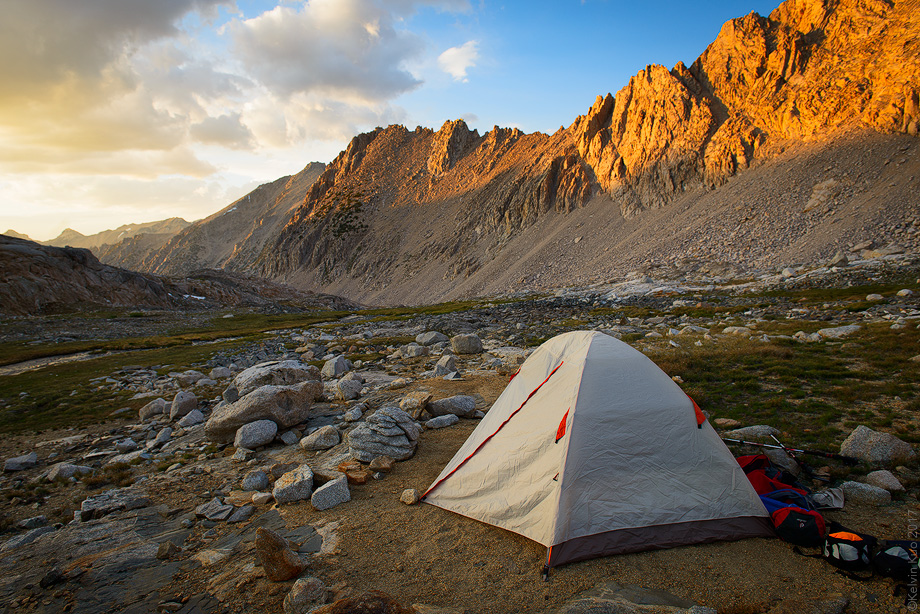
After roughly 6 miles, we made it to our campsite at Dry Lake. I forgot to get a few photos of our setup.

After a short break for water, food, and to set up our shelter, we set off toward the summit of San Gorgonio Mountain.

View of the valley area on the bottom of the mountain.

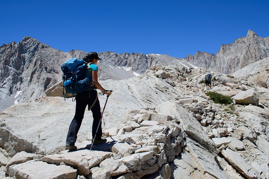
The trail then splits toward the summit, which you are also allowed to camp at. The elevation may not be very friendly up top since there were still symptoms of altitude sickness for some even at our campsite.

Sarah and Melody looking at the map to determine if we could summit. We underestimated the altitude and lack of oxygen.

The landscape changes drastically to more of a rocky surface. There are very sparse sections of trees which prevent you from being hit by the sun’s rays.


up and up we go, towards our next checkpoint where we spotted the memorial of a tragic airplane crash.
On December 1, 1953, a Douglas C-47 Dakota, serial number 45-1124, crashed at the 11,000 feet (3,400 m) level on the eastern face of the mountain. The C-47 was en route from Offutt Air Force Base, Nebraska to March Air Force Base near Riverside, California when it struck the mountain at night in the middle of a storm. “The aircraft was last heard from at 9:51 p.m. Pacific Standard Time, Monday.” Thirteen people died.[5]
Nearly one month after the C-47 accident a Marine Corps helicopter crashed on the mountain in coordination of the efforts of recovering the victims. The three crewmen of the helicopter survived the impact.[6] Most of the wreckage of the two aircraft remain on the mountain and are accessible via the Fish Creek Trailhead or the South Fork Trailhead.
In more recent years, the mountain has claimed the lives of Frank Sinatra’s mother and Dean Martin’s son, in unrelated plane crashes

View down the side of the mountain, only a few more miles to the top.

Now, you can see that the trees are gone, and some spots of snow that still have not melted away.

Melody on the ice patch, which proves to be both tricky and exhilarating.

This next shot reminds me of half dome.

Unfortunately, only a few hundred feet from the top we decided to turn around. It was nearly 4 pm and we knew that we had to head back so we wouldn’t be trapped in the dark. But the light was changing to a golden glow, which accented the trees perfectly on the way down.

Tired from altitude and the mileage.

But we had to keep on trudging along.

The light was just beautiful on the trees, creating a wonderful scene.

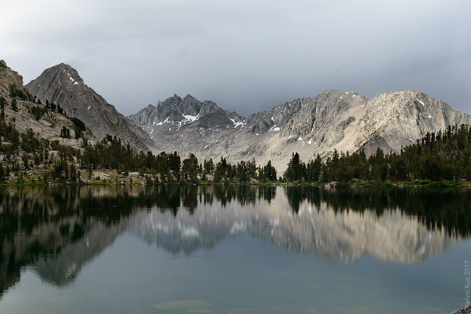
The next morning, I decided to get up around sunrise to get a picture of an extremely calm Dry Lake. I love the mirror effect of these peaceful bodies of water.

Sarah, still hiding from the brisk mountain air.

Picture time! On our way back, we crossed the water again, this to reference on how deep the streams were.

You might also like